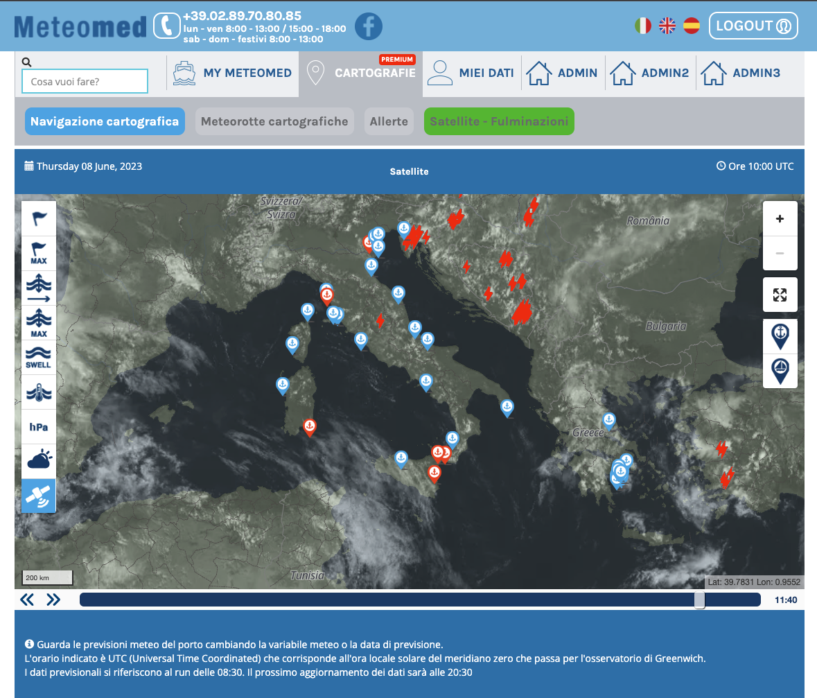
The Nowcast service allows, in real time, to see how perturbations, clouds and storm phenomena are evolving.
It makes use of the Second Generation Meteosat (MSG) with RGB (red, green, blue) composition and channels between 01-11. Therefore the product is divided into the wavelengths of the visible (to be used during the day with high detail) and infrared (to be used during the night). In this way it is possible to distinguish convective or thunderstorm systems (intense white colour), mists (saturated yellow colour), low clouds (light yellow colour) and high clouds (white colour, with a ragged shape).
The lightning strikes recorded in real time and in the last few hours are superimposed on the satellite product. It is thus possible to know the exact position of the storms but also how they move by tracing the trajectory.
In summer it is thus possible to identify thunderstorm systems by crossing lightning strikes with the reflectivity of clouds (in the case of thunderstorms it takes on a white colour), as well as understanding how the storm mass moves in space and time. Summer storms are often associated with unexpected gusts of wind, defined as downbursts, which are very dangerous because they are sudden and intense and can in some cases exceed 50 knots.
Meteomed now allows us to detect these storm cells earlier and prevent the effects.
In winter the service is instead very useful in identifying fog. Using the visible channel, being low clouds, they will appear yellowish in color and will be very compact, slowly evolving. Even at night the mists will be identifiable thanks to the infrared channel.